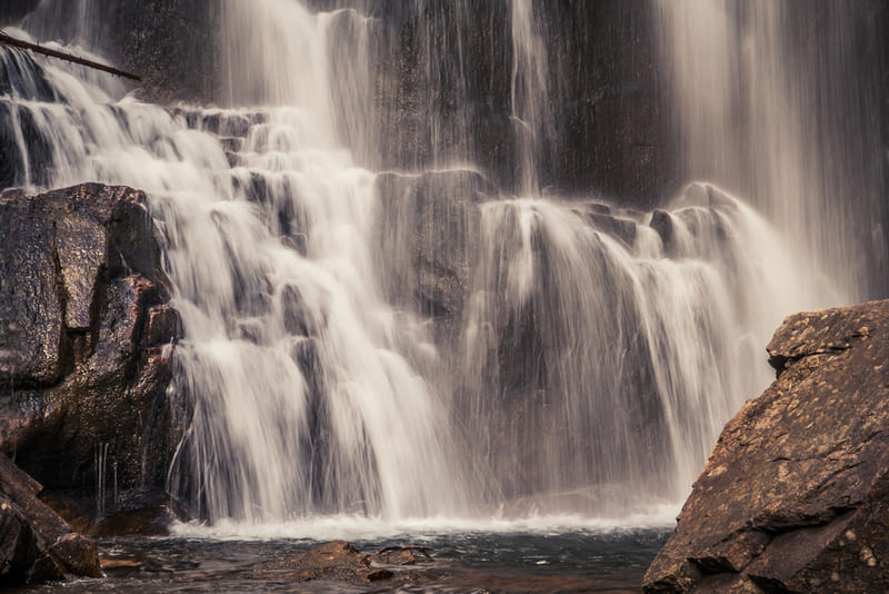
Located near Redford along the southern border of Montana, Calamity Falls is a beautiful cascading water feature along the West Fork of Rock Creek in Custer Gallatin National Forest.
Accessible via a short hiking path, the waterfalls are only one of the idyllic landmarks preserved in the park and provide a fantastic location to engage in hiking, fishing, and backcountry camping.
Calamity Falls, Carbon County Stats
- Elevation: 8268 feet
- Latitude: 45.16149
- Longitude: -109.52093
- How to Get There: Calamity Falls, Montana, can be reached along the West Fork Trail, accessible from the trailhead at the end of W Fork Road in Custer Gallatin National Forest.
Recreation Activities
Hiking

With no roads cutting through the Custer Gallatin National Forest, the only way to reach the falls is by foot. Following the West Fork Trail, the falls are only about 1.3 miles from the trailhead.
However, the entire 11-mile trail to Sundance Pass features many additional attractions for those looking to extend their hike.
In addition, side trails can be found branching from the road for hikers seeking further adventures exploring the deeper corners of Custer Gallatin National Forest.
Fishing

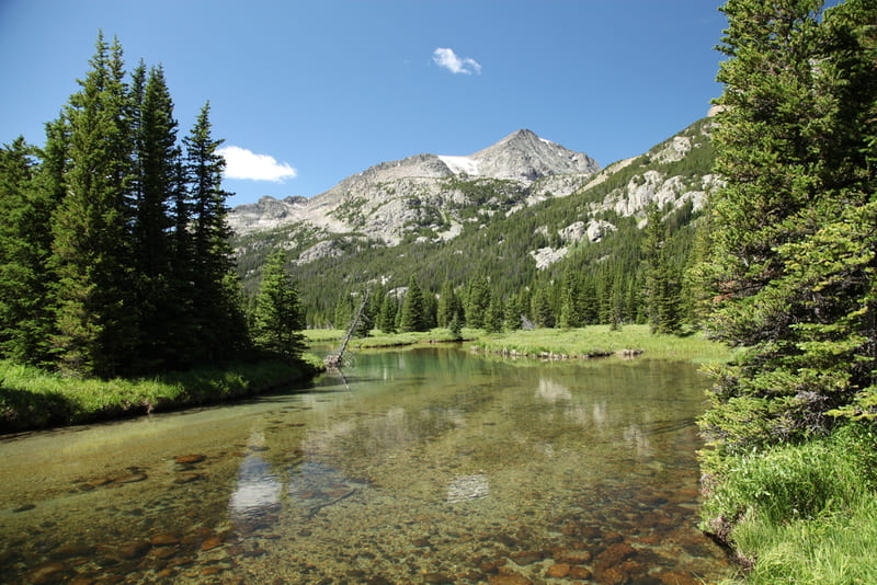
Carbon County offers fantastic fishing opportunities both at Calamity Falls and along the entire stretch of West Fork Rock Creek.
Known for being an excellent spot for native warm water fish species, visitors to the falls can expect to catch Brassy Minnow, Brook Trout, Stickleback, Flathead Minnow, Lake Chub, and more.
Camping

There are plenty of camping opportunities in the region surrounding Calamity Falls. The Cascade Campground is the nearest serviced campsite to the trailhead. The campground features 30 sites, public toilets, and is reachable by car.
Dispersed camping is permitted in Custer Gallatin National Park, and visitors are welcome to camp almost anywhere in the preservation except for marked recreational zones.
Stay updated with the park’s dispersed camping regulations before visiting.
Horseback Riding
For those more inclined to explore Custer Gallatin National Forest on horseback, Elk River Outfitters offers guided riding trail services from the nearby community of Red Lodge.
Guests will explore rock creek as they are carried along the rising vista to the vantage point, from where they will receive breathtaking views of the seven mountain ranges that make up Carbon County’s picturesque horizons.
Trail Routes
Calamity Falls via West Fork Trail
The easiest method of reaching Calamity Falls for those not interested in long and rigorous hikes is to access West Fork Trail from the trailhead along W Fork Road.
From this access point, visitors only have a 1.3-mile hike along West Fork Rock Creek before they reach their destination. A further 0.3-mile walk along the trail and visitors will arrive at the nearby Sentinel Falls.
The route to both falls is a total 3.4-mile out and back hike that can be completed in an hour or less.
West Fork Trail via Sundance Pass
Of course, for those looking to explore more of Custer Gallatin National Park’s preserved landscapes, the West Fork Trail is also accessible from its southern end.
From the Lake Fork Trailhead near Lions Cub Camp, visitors will begin their hike along Lake Fork Trail for several miles before arriving at a fork in the road.
Continuing along Lake Fork Trail to the right, the path eventually turns into the winding Sundance Pass trail that leads to the West Fork Rock Creek.
Crossing over the creek, the trail weaves to the northeast and becomes the 11-mile West Fork Trail that will lead visitors past Sentinel Falls and directly to Calamity Falls.
From the falls, visitors can finish their hike at the West Fork Rock Creek Trailhead, where they can arrange transportation back to their cars.
In total, the hike is a 19.7-mile point-to-point trail with an elevation gain of about 3,841 feet and is primarily only undertaken by more experienced hikers.